Description
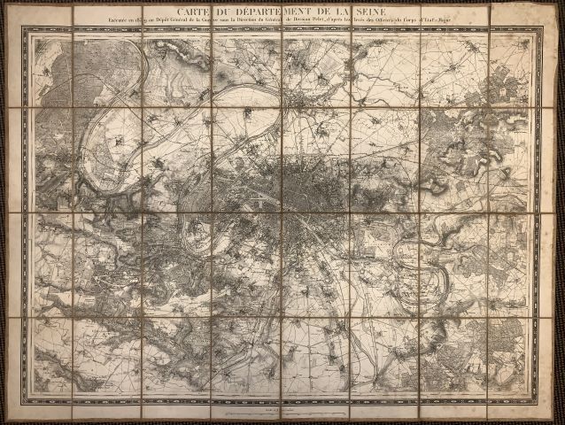
GENERAL PELET. Map of the department of the Seine, executed in 1839 at the Dépôt général de la Guerre. Paris, 1839/1857. Black and white. Plan in 32 segments, backed and folded. Moisture stains on verso. 820 x 1110 mm. This map shows the department of the Seine under the direction of General Pelet. Scale : 1/40 000. Map centered on Paris, corresponding to an area of 53 km by 38 km, thus smaller than the actual Île-de-France, but larger than the Seine department. This map is rich in details, with the relief well represented. This map was reprinted many times until the beginning of the 20th century.
144
GENERAL PELET. Map of the department of the Seine, executed in 1839 at the Dépôt général de la Guerre. Paris, 1839/1857. Black and white. Plan in 32 segments, backed and folded. Moisture stains on verso. 820 x 1110 mm. This map shows the department of the Seine under the direction of General Pelet. Scale : 1/40 000. Map centered on Paris, corresponding to an area of 53 km by 38 km, thus smaller than the actual Île-de-France, but larger than the Seine department. This map is rich in details, with the relief well represented. This map was reprinted many times until the beginning of the 20th century.